Local Insights improve climate-smart mapping for better adaptation planning for coastal agriculture in Bangladesh
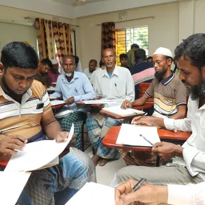
Patuakhali, Bangladesh, May 23, 2024 — Building on findings from 10 district-level workshops, a series of workshops were held in Golachipa Upazila, Patuakhali, Bangladesh to validate the results of Climate-Smart Mapping and Adaptation Planning (CS-MAP) activities. These workshops aimed to gather local stakeholder insights on climate risks and develop site-specific adaptation strategies to cope with risk-prone conditions. Supported by the
Local Insights improve climate-smart mapping for better adaptation planning for coastal agriculture in Bangladesh
Patuakhali, Bangladesh, May 23, 2024 — Building on findings from 10 district-level workshops, a series of workshops were held in Golachipa Upazila, Patuakhali, Bangladesh to validate the results of Climate-Smart Mapping and Adaptation Planning (CS-MAP) activities. These workshops aimed to gather local stakeholder insights on climate risks and develop site-specific adaptation strategies to cope with risk-prone conditions.
Supported by the International Rice Research Institute (IRRI) under the CGIAR Initiative on Asian Mega-Deltas (AMD), the Center for Environmental and Geographic Information Services (CEGIS) organized the event in collaboration with the Department of Agriculture Extension (DAE) Golachipa Upazila Office, Patuakhali.
Situated in a low-lying delta, Patuakhali’s predominantly agricultural economy faces severe challenges from riverine flooding, cyclones, storm surges, and salinity.

The workshops brought together farmers from three different unions, Dakua, Golachipa, and Amkhola Union to assess current climate risks to various crops across different seasons. These workshops highlight the importance of community involvement in climate adaptation planning. By combining scientific knowledge with local community experiences, the CS-MAP is a participatory approach that aims to create actionable adaptation plans that enhance agricultural resilience in Bangladesh’s coastal regions. These efforts are crucial for supporting policymakers in making informed decisions to safeguard agriculture productivity against escalating climate risks. The insights gathered were instrumental in fine-tuning adaptation plans to ensure their relevance and effectiveness.
Farmers from Dakua, Golkhali, and Amkhola Unions participated, discussing current climate risks, adaptive measures, and the scope for necessary investments in their areas. The workshops identified T. Aman rice and mungbean as the major crops produced in Patuakhali.

For T. Aman rice production, the most common climate risks were identified as rainfall and waterlogging due to tidal intrusion. To adapt, farmers recommended improving drainage facilities and introducing new varieties such as submerged and short-duration varieties to reduce yield loss.
For mungbean production, the common climate risks were identified as irregular rainfall, late sow conditions, drought, salinity, and tidal cyclones. Suggested adaptation pathways include improving the drainage system and irrigation facilities, introducing short-duration varieties, using weather forecasting, planting Early T. Aman rice varieties, utilizing buried pipes, and managing water flow.
These workshops highlight the importance of community involvement in climate adaptation planning. By validating previous district-level findings and incorporating local insights, the CS-MAP work is advancing toward sustainable and resilient agricultural practices in Bangladesh.

This collaborative effort addresses immediate climate challenges and supports long-term food security and livelihood resilience in the face of a changing climate. The outcomes of the workshop will inform future steps and policy decisions, reinforcing the resilience of agricultural systems in the Asian Mega-Deltas.