Scientists develop new digital tools for enhancing water management in a changing climate
As the world grapples with intensifying climate shocks, the challenge of managing water for agriculture has never been greater. Erratic rainfall, shrinking aquifers, and unsustainable land use are stretching ecosystems and livelihoods to their limits. Yet amid this mounting crisis, scientists and policymakers are finding hope in data — and in a new generation of digital tools designed to make

Scientists develop new digital tools for enhancing water management in a changing climate
As the world grapples with intensifying climate shocks, the challenge of managing water for agriculture has never been greater. Erratic rainfall, shrinking aquifers, and unsustainable land use are stretching ecosystems and livelihoods to their limits. Yet amid this mounting crisis, scientists and policymakers are finding hope in data — and in a new generation of digital tools designed to make every drop count.
That was the focus of a recent webinar, “Water Impact Calculations and Natural Resource Management Tools,” which brought together researchers developing cutting-edge digital innovations to improve irrigation efficiency, bridge data gaps, and strengthen climate resilience from farms to entire river basins.
From need-based irrigation scheduling to digital natural resource dashboards and hydrological modelling under future climate scenarios, the webinar, hosted under CGIAR’s Multifunctional Landscape (MFL) Science Program, showcased how data-driven approaches are transforming how water and land are managed.

Water, data, and the productivity challenge
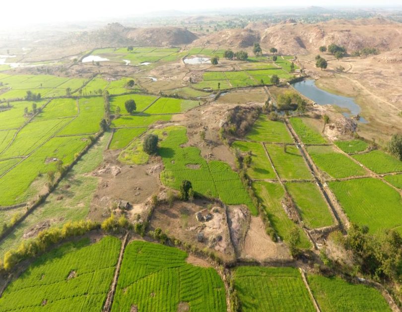
Water and land are the foundations of agricultural productivity. Yet both are under immense stress due to changing weather patterns, resource depletion, and inefficient management practices. Traditional irrigation often relies on fixed calendars rather than crop needs, leading to overuse or underuse of water and declining soil health. Meanwhile, much of the scientific data on soils, hydrology, and climate remains trapped in complex formats inaccessible to the farmers who need it most.
“Similar to land, water is a connector across the three Rio conventions – Biodiversity, climate, desertification/land degradation: How we measure, manage, and share it determines the sustainability of our landscapes” noted Cargele Masso, a Principal Scientist at ILRI, and leader, global engagement, science-based advocacy, and co-learning for the CGIAR multifunctional landscapes science program.
The webinar featured three complementary approaches that together offer a pathway to smarter water governance at the plot, landscape, and basin scales.
Smarter irrigation through a Water Impact Calculator
Kaushal K. Garg, a Principal Scientist in Natural Resource Management at ICRISAT, and an expert in landscape management and hydrology introduced the Water Impact Calculator (WIC), a tool developed to help farmers move from calendar-based to need-based irrigation scheduling.
“Irrigation is inevitable in modern agriculture, particularly in a climate crisis,” he explained; “ the challenge is how to do it efficiently so that we conserve water, reduce costs, and enhance yields.”
The WIC uses a field-scale water budget approach that factors in rainfall, soil moisture, evapotranspiration, and crop growth stages. By entering basic data on soil type, depth, irrigation method, and weather, farmers can determine exactly when and how much to irrigate, preventing both wastage and stress.
The WIC is being transformed into a user-friendly software platform . Beyond farm-level management, the tool can help researchers update decades-old FAO crop water coefficients using data from modern, drought-tolerant varieties. This could revolutionize irrigation planning across regions with physical or economic water scarcity.
Connecting landscape insights to farm decisions
While the WIC optimizes water use on individual plots, the Natural Resource Management (NRM) Tool, presented by Nagarjuna Reddy Nukala, an Associate Scientist in Soil Science at ICRISAT tackles a broader challenge: how to connect the wealth of landscape-level scientific data with the everyday decisions of farmers and extension agents.
“On one hand, we have complex scientific data on soils, water, and topography,” Reddy said. “On the other, farmers need simple, reliable answers for their specific plots. The challenge is bridging that gap.”
Developed under ICRISAT’s long-standing watershed management program, the NRM Tool integrates data from the Land Resource Inventory (LRI) and hydrological frameworks to offer a holistic view of the landscape. Through an interactive GIS dashboard, users can access parcel-level details on soil health, slope, and fertility; simulate cropping system designs under different rainfall scenarios; and generate fertilizer recommendations tailored to specific crops.
A pilot project in Bundelkhand, central India, demonstrated the tool’s potential. By combining soil maps at a 10-meter resolution with hydrological monitoring, the tool helped optimize the use of available resources, including nutrients, and in designing cropping systems. Farmers could visualize how interventions like rainwater harvesting and crop diversification affected water budgets in dry, normal, and wet years.
The NRM Tool is being tested by farmers and policymakers. The team aims to make it a public, open-source decision support system in 2026.
“This tool empowers both farmers and planners,” said Ramesh Singh, a Principal Scientist (Landscape Resource Conservation) and Theme Leader (Regenerative Landscapes) at ICRISAT who moderated the session. “It allows diagnostic-based, tailor-made solutions rather than one-size-fits-all recommendations.” While the tool is data-intense, it calls for public-private partnerships for integrated landscape management.

Modelling water under a changing climate
At a larger scale, Aiendrila Dey, a Consultant in Climate Modelling at ICRISAT, focusing on climate variability, hydrological extremes, and model-based risk assessment presented a multi-model framework for assessing blue and green water fluxes under climate change, a crucial step toward understanding how future rainfall and temperature shifts will affect water availability.
Her study, conducted in the Damodar River Basin in eastern India, compared three models: HYSIM, a simple conceptual model; SWAT, a semi-distributed, process-based model; and JULES, a fully distributed model incorporating fine-scale landscape data.
Results showed an expected increase in peak monsoon flows and reduced non-monsoon flows, underscoring the need for adaptive water storage and management strategies.
“Different models tell different stories,” Dey noted. “Using multiple models helps us understand uncertainty and make more robust decisions for climate adaptation.”
From data to policy: toward smarter governance
A key takeaway from the discussion was the need to align these digital innovations with national policy and investment priorities.
Ramesh highlighted that India’s Ministry of Rural Development is now integrating land resource inventory and hydrology data to guide rainwater harvesting strategies, a move that reflects the practical policy relevance of such tools. He added that the NRM Tool’s fertilizer module could support targeted subsidy reforms, reducing costs while protecting soil health.
“These tools offer science-based alternatives to blanket policies,” Ramesh said. “They can help governments and development partners invest where it matters most, in understanding and managing natural resources rather than subsidizing inefficiency.”
In many low- and middle-income countries, subsidies or financial supports often support inputs like fertilizers instead of investing in the biophysical knowledge needed for sustainability. “If we understand our landscapes better,” Cargele argued, “we can design interventions that are efficient, equitable, and environmentally sound.”
A digital future for water and land management
In closing, the speakers agreed that digital innovation is not about replacing traditional knowledge but enhancing it through data-driven insights. The three tools presented – WIC, NRM, and the hydrological modeling framework – together demonstrate how science can inform smarter, more resilient natural resource management at every scale. From field to watershed to basin, we must connect data, people, and policies to ensure water security in a changing climate
As water becomes an ever-scarcer commodity, such knowledge exchanges are vital. They remind us that technology, when grounded in science and scaled with empathy, can turn data into resilience and transform how humanity stewards the resources that sustain life itself.
By Wandera Ojanji